Tuesday, November 18, 2014

Colorado National Monument

Colorado National Monument,  Oct. 19-29, 2014

Sylvan Lake Park was getting too cold to stay, so we headed on down I-70 about 2 hours to Colorado National Monument. We had visited here as a family (I think) many years ago, but couldn't stay long as it was summer and we were all on vacation. Naturally, we felt we needed to cram in as much as we could in the 2 months. And Levi and I biked here maybe 8 years ago, but only stayed a couple of days. Again, not enough time to get to know the place. Now, however, we're not on vacation; rather, this is our life, so we can relax and spend as much time as we want in one place. As we pulled into Saddlehorn campground, we found a spot with a view and settled in. (Unfortunately, the photos of the campsite were taken on my phone, and were lost to a micro-SD card failure). For the next week or so, we walked along the rim in the morning, hiked the valley, and bicycled the rim road. Weather was just fine: high 70, low 40.

Walking along the rim:
Double click on any photo to see it larger


Double click on any photo to see it larger


Below: Hiking the valley (6 miles--surprisingly taxing...the sun, we think). Also, the trail began at the top, dropping down steeply to the valley, which meant that several hours later, we had to climb back up to the truck.

Double click on any photo to see it larger


Double click on any photo to see it larger
Beautiful colours and patterns in the rocks
Dead Horse Point State Park, Oct. 29-31, 2014

We left Colorado National Monument after about a week, heading for...well, generally southwest, but no definite plan. We kind of thought we'd head for Goosenecks of the San Juan State Park, which we'd heard a lot about, so off we drove, in that general direction. However, on the way through Moab, we saw a turnoff for Dead Horse Point State Park, a campground at the end of a one-way road that stops at Dead Horse Point--a colorful name with a sad story behind it. Legend has it that in the early 1900s cowboys herded wild mustangs out onto this 30-yard wide neck of land with 2000 foot drops on all sides. They then fenced off the narrow neck behind the horses. Once the horses were thus corralled, the cowboys chose the horses they wanted, and left the rest trapped. The horses eventually died of thirst--in sight of the Colorado River, 2000 ft. below.

On a whim, we called Dead Horse Point Park, and, yes, there was just one site left, right out on the Point--someone had just cancelled. We sped for half an hour to get there before it was taken. Arrived just in time, but alas, found the site too small for our trailer. Drat! A few miles back inland, though, we found a quiet site at Horse Thief BLM Campground $7.50 per night.


Our site at Horse Thief BLM campground
Leah is training binoculars on that thread of a dirt road in the upper middle of the photo. That's the Shafer Trail, a jeep road that switchbacks down that distant cliff, following the Colorado River into Moab. We drove that road in the van a couple of years ago. One of the most spectacular roads we've ever driven.

The next day, we drove out to the Point, and walked around for 3 hours watching the light change. From many of the viewpoints, we could see the Shafer Trail. We met an older German guy who said he'd driven that road in a Buick Super (the model with the 3 portholes on the side)! That would be about 1960! The road would have been a lot rougher back then.

 I wouldn't want to be stranded out here in the heat of summer, like those poor horses. What were those cowboys thinking?!
Double click on any photo to see it larger

Shafer Trail visible in center.


...more of the Shafer Trail running horizontally, lower left of photo.

Double click on any photo to see it larger
You can just see a small section of the Colorado river, upper left.

A kind lady took our picture at Dead Horse Point

Double click on any photo to see it larger
Last sunlight of the day... 

Moab and Ken's Lake, Oct. 30- Nov. 4, 2014

Horse Thief was a lovely campground, but aside from Dead Horse Point and some hiking, there wasn't much to do. We found ourselves wanting a bit of civilization: restaurants, showers, propane, dump site, thrift Stores, etc. Time to head for Moab.

Delicious breakfast at Eklectica Cafe:

Good breakfast of Huevos Rancheros, as well as tables that doubled as display cases for local craftspeople, including jewelry makers. Leah bought a turquoise neckless!


Excellent Huevos. The green chili was delicious! Sorry for the shadow thrown by the lens when the flash went off. Note the jewelry under the glass that forms the table.
Our site at Ken's Lake, a BLM campground 8 miles outside Moab--$7.50 per night with Senior Access Pass:

Nice site in the open, few neighbours, quiet, surrounded by cliffs and mountains, close enough to town.
We met the campground host, who has lived for 13 years on-site in an airstream with a wood stove in it. When he needs to move, the chimney collapses, and he can seal the hole in the roof. He mentioned off-hand that this year the campground had "a mountain lion problem". Intrigued, we asked what he meant. He said he'd recently found fresh deer kill with lots of lion tracks at a nearby waterfall frequented by hikers. Usually, you'd never see any sign of lions this close to a populated area, but this lion was different. The host was concerned enough that he invited a ranger out to investigate, and she advised that lions like this watch an area--like the waterfall--and look for patterns of behaviour in their prey. This allows them to set up a more effective ambush. She advised the host not go up to the falls alone, especially at dawn or dusk. We were forewarned...so we hiked up there mid-morning:

Our trailer is in a tiny cluster of RVs middle right of photo, up against the tan boulder on extreme right

Double click on any photo to see it larger
Part way up to the falls; campground barely visible directly right of Leah. Ken's Lake just beyond.

Rushing water downstream of waterfall. Thankfully, no sign of lion kill.

Double click on any photo to see it larger
Leah was happy about that.

Full size of waterfall. A big deal so near Moab, which only gets 5-10 inches of rain per year. This was only a trickle a couple of years ago.

Double click on any photo to see it larger
On the way back to camp. A splash of Fall colour just left of middle.
One of the reasons we saw a waterfall and a rushing river in such a dry place was that we'd been pounded by heavy rain and 50 mph winds for 2 days. Our trailer was situated side-on to the wind, so we were definitely rockin' and rollin' all night long.

After the storm, a double rainbow:


After the hike, we decided to follow an interesting looking road, the La Sal Loop road. It started down in the valley where we were camped, but ascended to a nearby mountain top, before twisting back down to Moab. A nice afternoon drive:

We interrupted this guy's browsing

Double click on any photo to see it larger
Near the top, we were in the snow. We saw only a lone snowplow coming the other way.

Coming down the other side


Almost down...

Near near river level.


All the way down, driving along the river toward Moab. Nice drive.


Hope you're all well.


Monday, November 3, 2014

Sylvan Lake State Park, Colorado

Oct. 17- 26, 2014

As we left Denver heading west on I-70, we hoped to get over Eisenhower Pass (11,000 ft.) without hitting snow or bad weather, and even though the weather cams at the Pass looked fine, you never know. In this case, however, all went well, and we sailed up and over the Pass without hitting the brakes or the gas. I just set the cruise to 60 and the truck did the rest: the built-in engine brake worked like a charm—really saved the brakes. We were heading for Colorado National Monument, a Monument Valley-esque area about 4 hours west of Denver. After about 2 hours, though, we felt like stopping to stretch our legs and gawk at the mountain beauty, so pulled off at the Eagle-Vail rest area and wandered inside the Visitor’s Center. As we admired the photos for sale, Leah struck up a conversation with the Volunteer at the Center, Steve Taylor—who also happened to be the photographer. In addition to recommending restaurants in Eagle, Steve mentioned that one of the most beautiful campgrounds in the state, Sylvan Lake State Park, lay only about 1/2 hour up a twisty road at 8500 ft, a gem, he claimed—and showed us photos, as well as an article in the Denver Post, to prove it. Well, that was enough for us. After jotting down the best restaurants in town, we started the drive to Sylvan Lake. The paved road became narrower the higher we climbed, until no more pavement. Just a curvy dirt road leading up…and up some more. Would we get a good site?…with a view…any generators or noisy neighbours? Our thoughts were interrupted by a sign: “This is bear country. Behave accordingly.” 


OK...

Almost there...

On the way to Sylvan Lake State Park
Sylvan Lake:


You can just see the campground mid-right in photo above. This is a campground mostly for fisherman, so there are many sites right on the lake; however, they are cheek-by-jowl close together. But the campground was nearly empty, so from our site on the lake we could only see one other camper and it was quite distant. 


Our site, Sylvan Lake State Park, Colorado


Beautiful... but cold (8500 ft.)
 We even had our own private dock:


Even from inside the trailer, the view was lovely:

Sylvan Lake from inside the RV
In the next few days, hikes around the lake revealed the remaining fall colours:
On a walk near Sylvan Lake
Walk around Sylvan Lake

This guy (below) hung around our campsite. I think he's a Stellar Jay??


More fall colours from a drive in the nearby mountains:


Near Basalt, Colorado.
Lonely tree on a lake.


The cold finally chased us out of Sylvan Lake, but we'll be back. 

Saturday, November 1, 2014

Barrie, Ontario to Bear Creek Lake Park, Denver, Colorado

October 1-16, 2014

Left Barrie on Sept 30th, about 5 PM, and spent the 1st night of the trip in the Walmart parking lot, Port Huron, MI. From there, spent about a week driving more or less directly southwest, and landed in Denver at Bear Creek Lake Park, near Morrison.

On the way:


...good food at Cracker Barrel,

...quiet sleeping spots at various Walmarts:

Walmart for the night...

...very quiet.

While parked at a different Walmart, perhaps in Nebraska, we struck up a conversation with a couple in an old Hitchhiker 5th wheel. I complimented him on what good shape it was in. The guy had been a drummer, but was now semi-retired, and they were heading southwest. Seemed like a nice guy, interesting, pleasant, even showed us inside his Hitchhiker, which he bought for about $15,000. It was a 1999 model, but well-made. Anyway, all was pleasant until the guy started badmouthing Obama: "I read that he's plotting to take over America; he's found a loophole in the law that will allow him to be reelected for a third term!" ...and other such conspiratorial stuff. I didn't ask what he'd been reading, but wouldn't be surprised if it included Fox News. Not sure what to make of it. And not the first time we'd heard rabidly anti-Obama sentiments. After that, we kind of disengaged as quickly as we could without offending. However, we'd already exchanged e-mails, and some days later, he sent Leah a Facebook friend request. She hasn't responded yet--not sure what to do. I get the sense that Republicans are so vicious and short-sighted that they've lost sight of one of the hallmarks of a successful democracy: compromise.

Anyway, it's good to be back near the mountains. Each visit, as we approach from the east, I get a little shiver when I first sight them, which, depending upon the weather, is about 50 miles out on I-76. This year, once in Denver, we decided to use Bear Creek Lake Park, just outside the city, as a base to explore some old haunts before we headed over Eisenhower Pass to get farther west and south for the winter. Bear Creek closes for camping at the end of October, and we were able to snag a discounted annual pass, which, combined with the already reasonable camping fee, got us hot showers, flush toilets, and electricity at the site for $15 a night.

During the week or so we stayed there, we walked and biked through the park, itself; and drove up into the mountains to revisit favourite haunts in the Front Range: Estes Park, Smokin' Dave's BBQ (best we've ever tasted) in Estes, the Peak-to-Peak Highway, Brainard Lake (10,000ft), Allenspark, Lyons, Nederland, and of course, umpteen thrift stores along the way. And Gavin: we even stopped at Camp Dick! Just wonderful to be here! Weather is mild and sunny in the day and cold (40 or so) at night--perfect sleeping weather.

Some photos:

Bathroom buddy, restaurant in eastern Colorado


Mural on abandoned gas station wall, Sterling, Colorado

At Bear Creek Park, Denver, our site:


Out for a walk, Bear Creek Park, near Denver

Fall colours, Bear Creek Park, near Denver

Riding on bike path, Bear Creek Park, near Denver

Fall walk, Bear Creek Park, near Denver


Leah, Bear Creek Park, near Denver

A chilly visit to Brainard Lake, about 10,000 feet, 45 minutes from Bear Creek Park
Took a chance on a pizza buffet in Golden, and it was the best I've ever tasted:

...Woody's wood-fired Pizza, Golden, CO. (Sorry: night shot with camera phone).
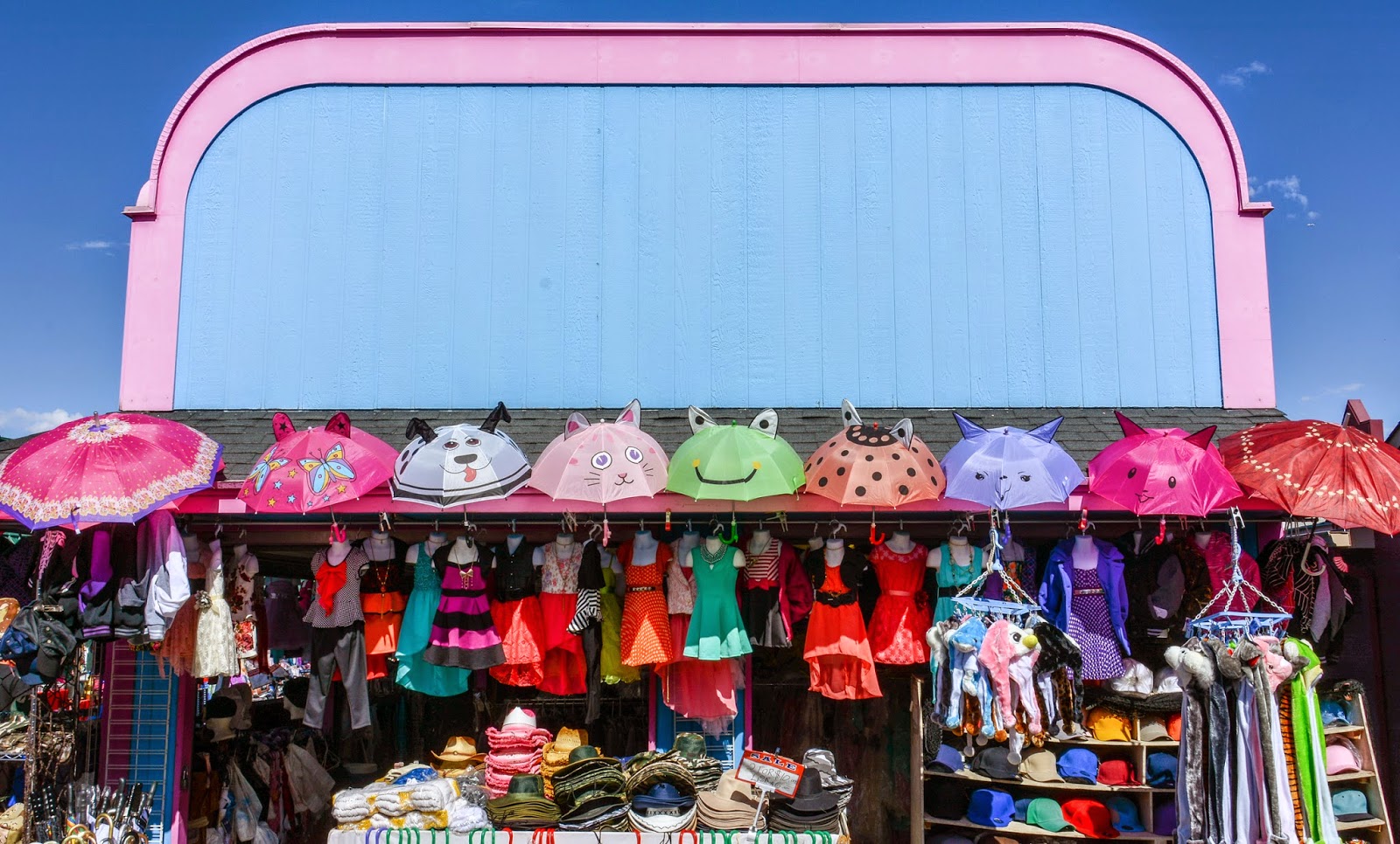
Visited an 80-acre flea market in Denver with some interesting items for sale:


Leah walked all the many aisles, but was a bit disappointed. I got bored with what was for sale, but found some mildly pleasing graphics:


While Leah roamed thrift stores, I tried my hand at street photography (don't think I have the stomach for it; feels like treating people poorly) in a rundown, but rapidly gentrifying area of downtown Denver:
Conversation
I did find an interesting detail at a bar:

 Back at the trailer, the sun set on another wonderful day:


Hope all is well with you.