Monday, April 29, 2013

Bisbee

Posted April 29, 2013

After 3 or 4 days in Tucson, it began to get too hot, so we moved to cooler climes--south, but also to higher elevation, at Bisbee, AZ. An old mining town built up the sides of mountains, it is now a tourist haven-come-hippee enclave. A liberal town in a conservative state. Leah walked around town visiting shops while I photographed an area that appeared to have been time-warped from the 1940s and 50s.

click any thumbnail to see full-sized photo


 This double-decker bus was permanently parked on the street outside what once was a Greyhound Bus Station. Somebody has a sense of humor.


Just liked the composition and color. Table is a restaurant.


The owner of the gym above was female. She must have won a competition, judging by the trophy in the right window. Here's a blow-up:


Some bumper stickers from Bisbee:


We tried to find camping IN Bisbee, but the only campground was full, so we had to stay at Turquoise Valley Golf and RV Resort, a short drive away in Naco, AZ. Our campsite was in a parking lot across the street from the golf course and clubhouse. It was also across the street--literally--from the Mexican border, really only a stone's throw. It was a bit eerie, too, as the border was a brilliantly lit rusty steel fence about 20 feet high--and it ran as far as the eye could see in both directions. Helicopters and planes  flew over frequently. There was even a tethered blimp high up in air, no doubt loaded with heat sensors and cameras, scanning for illegal immigrants.

To add to the eerieness, about a 1/4 mile away we discovered a large abandoned US Army base called Camp Naco, originally built in the early 1900s, partially in response to Pancho Villa's raid on Columbus, NM. My camera quivered with anticiption...abandoned places make us both tingle...but, alas, the entire site had been fenced off, and I could only get photos from the top of a ladder. I had wanted to do some HDR shots from inside the buildings, but the fencing prevented it. Still, an interesting sight.

A small section of Camp Naco


Bike ride near Camp Naco. Mexico about 100 yards to the left.


Made us a little nervous...but we drove up anyway


At the top. Mexico to the left.

As it turned out, we mostly spent days exploring Bisbee and the surrounding area, and evenings back at the trailer in Naco. Did a few bike rides and walks, as well.

Stay well...

Catalina State Park, Sabino Canyon

Posted April 29, 2013

March 14-??

Got too hot in Joshua Tree, and we weren't really that impressed with it, so drove back to Tucson and stayed a few days in Catalina State Park, just on the outskirts of the city. Had a few days of thriftstoring, hiking and generally exploring. 

Hiked in Sabino Canyon--a park on the edge of the city. A winding paved trail for walking or biking--maybe 5 miles long, it climbed a fairly deep canyon, following a river up into an alpine area. We walked in the late afternoon. It seemed like wilderness: not too many people, no cars, no garbage, no houses...but every once in awhile, an electric shuttle would pass, carrying 10 or 15 people up the canyon. Some would get off at marked stops along the route, whereas others would ride the entire way up and back. Even with the shuttles, we were mostly alone. 
Toronto has High Park...Tucson has Sabino Canyon
Sabino Canyon


Sabino Canyon: Interesting patterns in rock
Sunset at Catalina State Park
 Sabino Canyon: Pleasing composition


At Sabino Canyon

At Catalina State Park

When Tucson got too hot , we thought we should head north for cooler temps; however, when I checked the weather around Arizona, I saw that Bisbee, at about 5000 feet, was cooler, even though it was farther south, and I'd read that it was worth a visit: old mining town, eclectic, with a hippee influenc...but that's another post.

Stay tuned...


Tuesday, April 23, 2013

Posted April 22, 2013 

Joshua Tree National Park, March 8-13, 2013

Once the solar panels were installed, we drove to the nearby Salton Sea, the largest lake in California. It was formed in 1905, when a natural dam broke and water flowed in from the Colorado River, flooding an area roughly 15 x 35 miles--and eventually submerging two small towns. Not only is it the largest lake, it's also the lowest in elevation, at about 220 ft below sea level. Since it has no outlet to the sea and is fed by rivers carrying agricultural runoff, its salinity increases each year, killing fish and causing algae blooms and boosting bacterial counts. It apparently often smells, but when we were there, it did not. There were, however, many abandoned buildings along the shore, and, like nearby Niland, the supply town for the Slabs, the road along the Salton Sea shore had seen better economic times.


Abandoned building along Salton Sea shore, with mountains of Joshua Tree National Park in background

Another abandoned structure along the Salton Sea shore


Abandoned bathing station, Salton Sea.


We wanted to camp somewhere along the Sea, but couldn't find anywhere suitable, so we kept going to Joshua Tree National Park. We toured the campground there, but it was too small, and everyone was right on top of everyone else. However, the ranger told us we could camp just outside the park entrance on BLM land...so that's what we did. Much nicer! And no one around.


After a quick walk-around, Leah approves of site selection. 


Photos of our site from all sides:


 Leah talks with Mark or one the kids in front the trailer 


 View out one side (playing with HDR)


 View out the back...


 View out the other side...

 Another view from out the other side from a different window ...

All by ourselves, as Jazzy takes in the new digs


We stayed here for about a week, exploring Joshua Tree National Park and visiting friends Cindy and Michael in Palm Springs, CA. They are staying at her brother's lovely second home, along with her parents. Had a great visit with all of them--so inspiring to see 90-year old people so vibrant and well. 

Those solar panels really work well. In combination with the 4 golf cart batteries and the abundant desert sun, we can run our toaster, microwave, TV--really anything we want, except the air conditioning. They give us the best of both worlds: isolation, quiet, and pristine views along with all the comforts of home--and no generator sound or smell.

Actually, it would have been handy to be able to run the air conditioning, as the temps were unseasonably warm: Palm Springs--just down the road--registered 99 degrees F! That's during the day, though; nighttime temps were much cooler, nice for sleeping.

Stay well...


Monday, March 18, 2013

Slab City & Solar Panel Installation

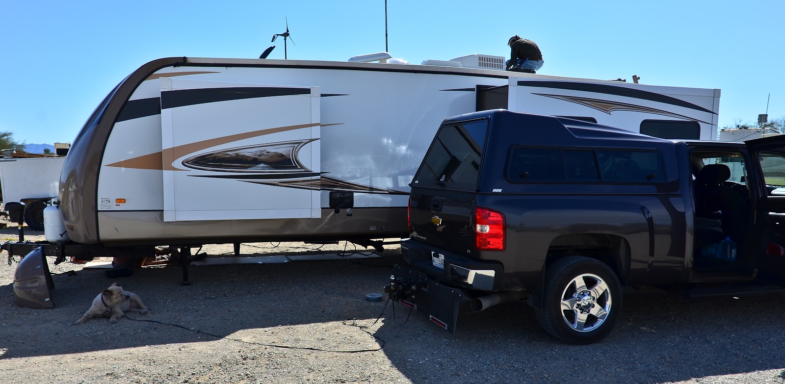
Wanted solar panels so that we could boondock, so phoned the company in Phoenix that installed them on our motorhome a couple of years ago. They said they could do it, but not for a week, so I called Solar Mike at Sunworks, in Slab City, and he said he could do it in a couple of daysF. Solar Mike has good reviews from the RV blogosphere, and I wanted to see Slab City and Salvation Mountain, anyway, so we drove the 250 miles from Tucson.

On the way into Slab City is Salvation Mountain, the 30-40-year life's work of Leonard Knight, whose religious experience prompted him to build and paint it.


Feels like we've fallen into the rabbit hole...

Here's a video about Salvation Mountain and its creator, Leonard Knight.

On to Solar Mike. Mike and his wife have been living in Slab City, off grid, since 1984. They home-schooled their two daughters in the complex of old buses fitted with solar panels that serves as home, office, and workshop.

Solar Mike's Sunworks office

Trailer in front of Solar Mike's workshop

Entrance to Slab City with the Sunworks, solar Mike's business, in background

Solar Mike's home, office, and solar car

Solar Mike's solar car

Jazzy watches solar panels being installed on trailer

We're now in Gilbert Ray campground outside Tucson while I do our taxes. Will move north in a few days.

Hope you have a great day!